|
|
The features on this page require a GENESIS64 Advanced license and are not available with GENESIS64 Basic SCADA . |

![]()
|
|
The features on this page require a GENESIS64 Advanced license and are not available with GENESIS64 Basic SCADA . |
![]()
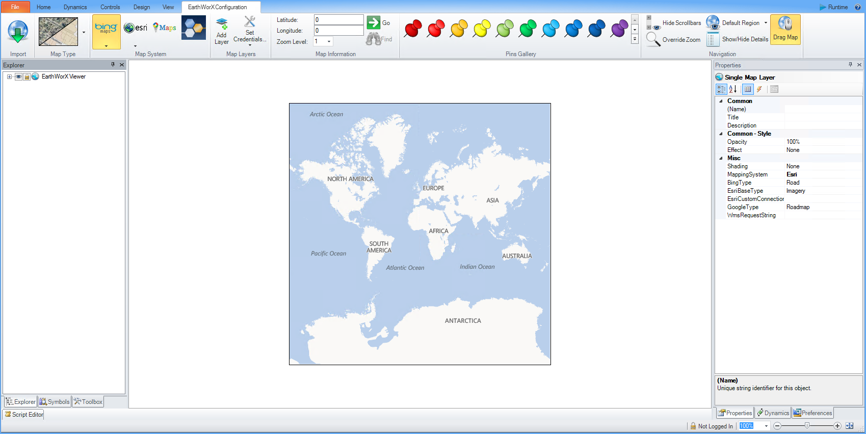
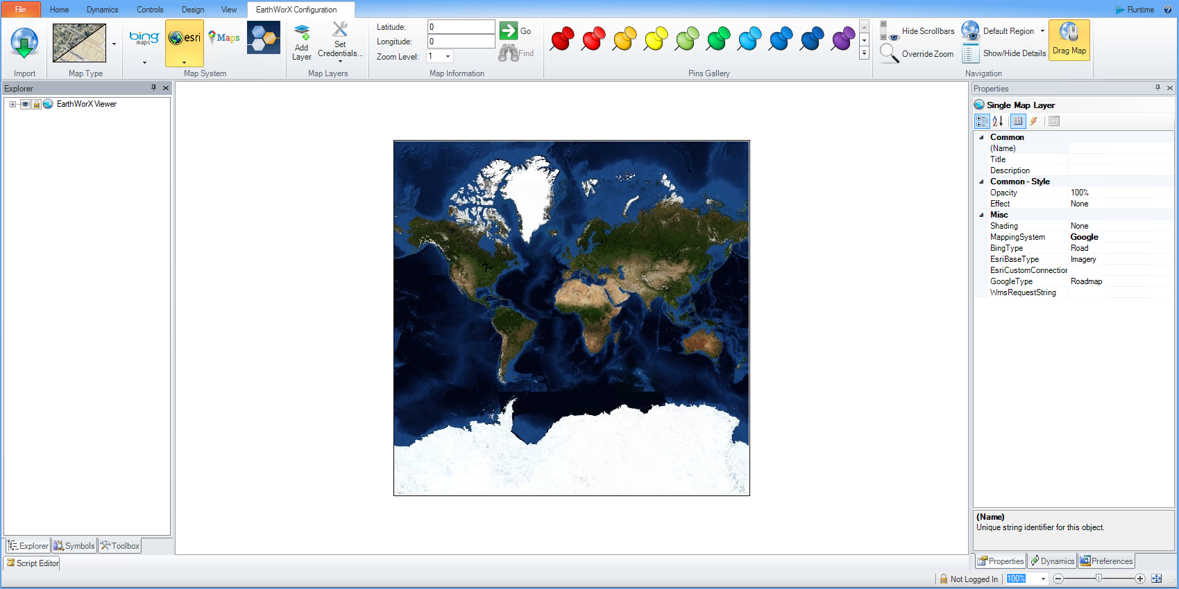
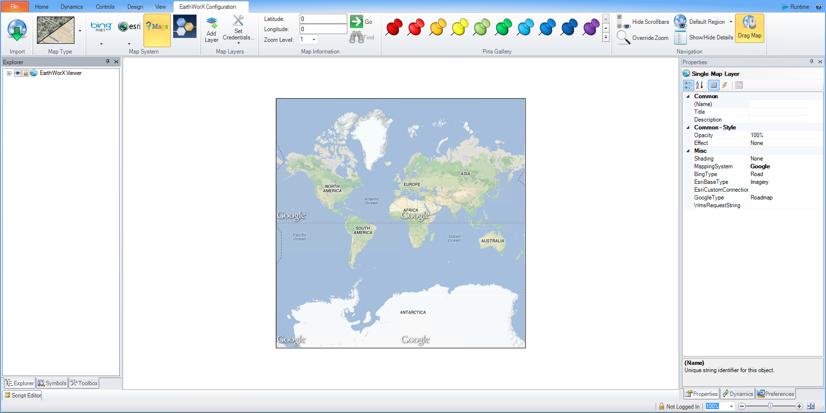
The Map System section of the EarthWorX Configuration Ribbon allows you to select which database your maps are being provided through. The Map System provides the user with 4 different options of map systems: Bing (default), Esri, Google, and OGC/WMS. Each option is described below along with options available for each system. For more information about the unique map types available for each system, please see Map Type.
Bing maps are fully navigational road maps that are available through the Bing network (bing maps are also the default map type for EarthWorX projects).
Esri maps are fully navigational satellite images available through Esri (Environmental Sciences Research Institute). By Setting Credentials, user's also have the ability to access Esri's vast online network of GIS layers.
Google maps are fully navigational hybrid maps available through Google maps.
Amap
OGC/WMS maps fully navigational GIS maps available through the OGC (Open Geospatial Consortium).
Geofences
Worker Path Replay
Selecting the ![]() icon will by default transform the selected region into a Bing Road map (No Shade).
icon will by default transform the selected region into a Bing Road map (No Shade).
Selecting the arrow below the icon offers the user a dropdown menu with 2 options:
Use the Bing Tile System - EarthWorX uses your Bing Maps Developer account for mapping. This option is available only after you have provided valid credentials using the Setup Connection option in the Map Layers section.
Use Demo Tile System - EarthWorX uses a free, account-less demonstration system for mapping. Some mapping features are not available with this option.
Selecting the ![]() icon will by default transform the selected region into an Esri Imagery map. The Esri network has access to 7 types of maps: Imagery (default setting), World Boundaries and Places, Streets, Topographic, Light Gray Canvas, National Geographic, Oceans, as well Custom tile sources available for download through the Esri database. Esri maps are can also be customized by Map Type.
icon will by default transform the selected region into an Esri Imagery map. The Esri network has access to 7 types of maps: Imagery (default setting), World Boundaries and Places, Streets, Topographic, Light Gray Canvas, National Geographic, Oceans, as well Custom tile sources available for download through the Esri database. Esri maps are can also be customized by Map Type.
Selecting the arrow below the icon offers the user a dropdown menu with 2 options:
Custom Esri Maps - Allows the user to toggle between Custom Esri Maps and Default Esri maps. Custom Esri Maps can only be accessed if the user is logged into the Esri network by setting Esri credentials or by logging in through the Esri website. By selecting this option, 6 Map Types will become available to the user as well as a Custom Tile Source which allows the user to directly access custom Esri and ArcGIS maps through the Esri database.
Default Esri Maps - Allows the user to toggle between Custom Esri Maps and Default Esri maps. This default setting allows the user to access the 6 preloaded Esri Map Types.
All types of maps served from an ArcGIS portal are supported if their version is 2.1 or higher. Users will be informed about the version of the map (and if it is possible to display in EWX) when they select it in the "Custom Esri Map Connection" dialog.
EWX is able to connect to the release version of ArcGIS servers with an address in the following format: http(s)://<host>:<port>/sharing/rest. The documentation of ArcGIS Runtime SDK mentions an existence of older, pre-release servers which cannot be used with EWX:
// An earlier pre-release version prior to rationalization and public release
// of the ArcGIS Online REST API may exist at http://<host>:<port>/sharing for
// the portal you are accessing. Developers are cautioned not to access this
// pre-release version. There are pitfalls to doing so and no advantages over
// using the released version of the api which is logically equivalent.
Image layers, Feature Layers, Raster Layers
These types of layers are supported for server connections.
Other Type of Layers
Other types of layers cannot be currently displayed on EWX maps when using the ArcGIS server connection.
The API recognizes the following types of layers that are currently usupported: GroupLayer, NetworkAnalysisLayer, Table.
Map Tiles and Raster Data
Some of the map servers provide map tiles or raster images which are hosted outside the map layers. These will be available directly at the server root url, as opposed to the map layers which are always served at the server address followed by a suffix.
Here is an example:
Tiles: http://birdseye.gis.vt.edu/arcgis/rest/services/pictometry2015_cached_web_mercator/MapServer
Layer: http://birdseye.gis.vt.edu/arcgis/rest/services/pictometry2015_cached_web_mercator/MapServer/3
These images are now accessible for EWX. Use the new property "UseEsriImageLayer" to turn them on/off.
Publishing Server Content on ArcGIS Portal
It is possible to host the ArcGIS server content on an ArcGIS Portal as a workaround for the maps that cannot be displayed directly. See the Connecting Iconics EarthWorX to a ArcGIS MapServer document.
ArcGIS Portal Content
ArcGIS Portal connection is not supported on HTML5 AnyGlass.
ArcGIS Server Content
Only image layers are supported and only if the server is public (no secured access) and if the servers is not „zoomed in“. That means that the layer on its zoom level 0 has to cover the whole map with 4 map tiles.
Note: The connection to Esri portals and servers is only supported for a desktop version of GWX. It will not work in AnyGlass/KPIWorX.
AnyGlass/KPIWorX only support basic basemaps.
Selecting the ![]() icon will by default transform the selected region into a Google map.
icon will by default transform the selected region into a Google map.
Note: Google map support has migrated to the newer Google maps API, which now requires user credentials. In order to make this work, you need to get an API key (see guide here: https://developers.google.com/maps/documentation/maps-static/usage-and-billing). After that, create a new entry in Workbench->Security->EarthWorX Credentials table, where you enter the API key in the Password column and any unique id in the Key column. In the EarthWorX connection setup, use the unique id as the Security Server Key. It works exactly the same as for setting up Bing connections.
Selecting the  icon will by default transform the selected region into an Amap map.
Selecting the ![]() icon will not automatically alter the map. A user will need to initiate an OGC/WMS connection first. If OGC/WMS credentials have already been set, the user will have access to all OGC/WMS options and maps.
icon will not automatically alter the map. A user will need to initiate an OGC/WMS connection first. If OGC/WMS credentials have already been set, the user will have access to all OGC/WMS options and maps.
See Also:
EarthWorX Configuration Ribbon
Import Button on the EarthWorX Ribbon
Map Type Section on the EarthWorX Configuration Ribbon
Map Information Section on the EarthWorX Ribbon
Pins Gallery Section of the EarthWorX Ribbon
Navigation Section on the EarthWorX Ribbon